Surveying
The foundational framework that informs preservation, rehabilitation, and development within the existing environment.
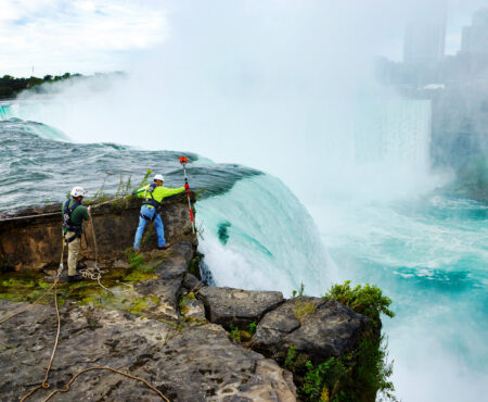
Our team provides detailed data that make dynamic design teams capable of developing comprehensive project solutions from start to finish. We use the most current, state-of-the-art equipment supported by CADD graphic workstations.
Boundary, Topographic & Site Mapping
- Boundary Surveys
- ALTA/NSPS Surveys
- Subdivision and Re-subdivision Surveys
- Horizontal and Vertical Geodetic Control
- Topographic Survey and Mapping
- FEMA Elevation Certifications, LOMA and LOMR-F
- Right of Way and Easement Surveys
- Wetland and Environmental Surveys
Construction & Development
- Construction Survey
- As-Built Surveys
- Remediation and Monitoring Surveys
- Grading and Design Surveys
- Volumetric Surveys
- Riparian and Littoral Surveys
- Utility Surveys
- Forensic Surveys
- Commercial and Industrial Surveys
- FAA 1A and 2C Certifications
Specialized Surveying
- Bathymetric Survey
- Hydraulic Survey
- Municipal Surveys
- Digital Terrain Modeling
- GIS Mapping
- High-Definition Laser Scanning Survey
- GPS Survey
Surveying Projects
See allLeadership
Professional land surveyors working from boundary surveys through preliminary planning stages, to the final record mapping—with field crews available to service all of New York State.
Roy Garfinkel, PLS
Sr. Vice President, Survey Manager
Jeremy Smith, PLS
Sr. Project Manager
Team
Justin Barnes
Instrument Person
John Connors
Instrument Person
Gerard Emborski, PLS
Sr. Survey Technician
Lucilia McAfee
Sr. Survey Technician
Steven Shepherd
Survey Technician